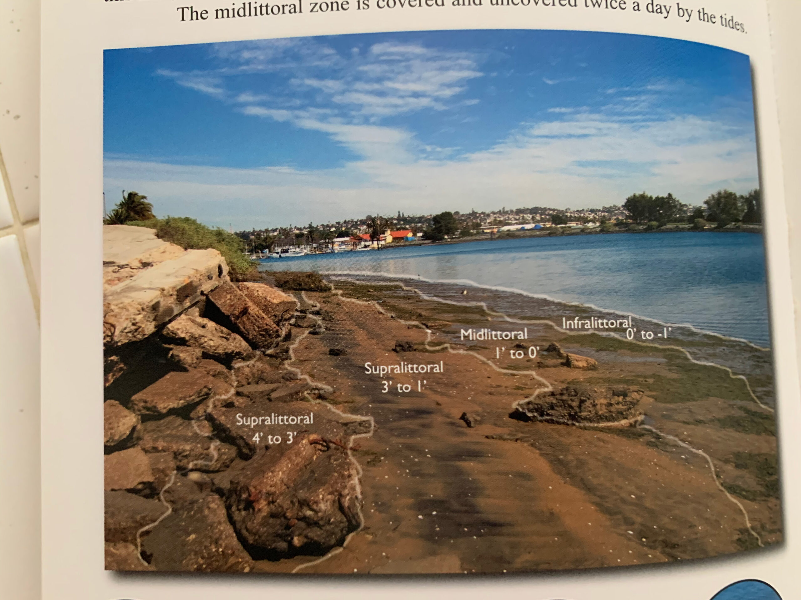
A diagram taht explains different sections of the shore known as the intertidal, or midlittoral zone. It was featured in a field guide published as a part of the Logs of the San Diego bay project.